The shoreline above the sea
A shoreline lifted above the water explains Arran’s flat coastal platform, the old cliff line and much of the road around the island.
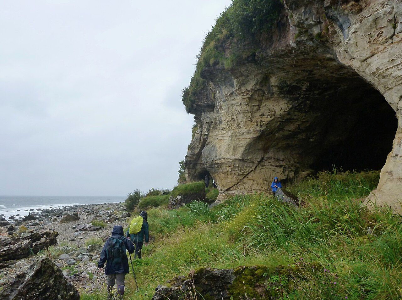
I used to think a shoreline had to meet the water. Arran makes that idea harder to keep. Here, much of the coast has another line above the present shore: flat ground left behind when the land rose after the ice melted.
What is a raised beach?
A raised beach is an old shoreline left above the sea when the land rose or the sea fell. On Arran, the raised beach forms a platform that runs around much of the coast. The name can suggest a strip of sand, but the feature that matters here is the flat ground: a former coastal level now sitting above the present shore.
That change of level is the whole point. The coast is not just the edge where land meets water; it includes an older edge, set back from it.
How high is it?
The raised beach lies about five to ten metres above the present shore. That is high enough to make the difference legible without turning it into a dramatic wall. The platform is a shelf in the land, not a cliff face, and its importance is as much in its flatness as in its height.
The walking route round the coast offers another way to think about that long coastal line: the walking route round the coast. The raised beach is not simply a place to look down from. It is part of the shape of the island.
Why is the old shoreline above the water?
Arran’s land rose after the ice sheets melted and lifted their weight from the crust. That is the explanation for the raised beach. The other possibility in the definition is that the sea fell, but the account here is of land rising as the weight of the ice was removed.
It is a useful correction to the usual way of seeing a coast. The water is not the only thing that changes; the land can move too. The raised platform records that shift, even though its present-day shape is quiet and level.

Why does the coast road follow it?
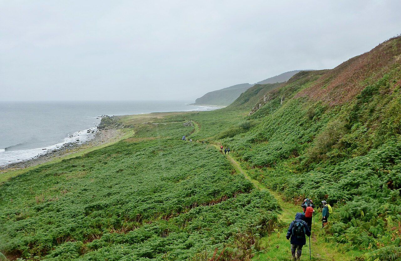
Much of the coast road on Arran runs along the flat raised beach platform. That seems less like a coincidence once the landform is clear: the road occupies the level ground left above the shore. It also makes the platform easy to miss. A road can read as a road, rather than as a clue to an older coastline.
For me, this is the most satisfying part of the story. The raised beach is not an isolated feature to admire from a distance; it is a broad piece of the island’s everyday shape. The coast road makes that point plainly.
Where did the old cliffs and caves go?
Old sea cliffs and caves now stand back from the water, behind the raised beach. They belong to the earlier cliff line, when the sea reached farther inland than it does now. The King's Cave and other west coast caves were cut when the sea reached that old line. A cave cut by an older sea is a good way into the subject: a cave cut by an older sea.
The cliffs are part of the same story, not a separate curiosity. the cliffs behind the east coast offer another reference point for thinking about the old line and the coast’s changed position.
Who lives on the raised beach?
Many island villages and farms are built on the flat ground of the raised beach. The platform is therefore more than a mark left by an older shoreline. It is also ground used for settlement and farming, because its level shape is part of the island people inhabit.
That is a more convincing account of the feature than treating it as a geological diagram. The old coast remains in the land, but it has become part of the present one.