Glen Rosa: reading a valley shaped by ice
Glen Rosa is more than a route towards the granite hills. Its broad valley floor makes the work of glaciers part of the walk, not merely its backdrop.
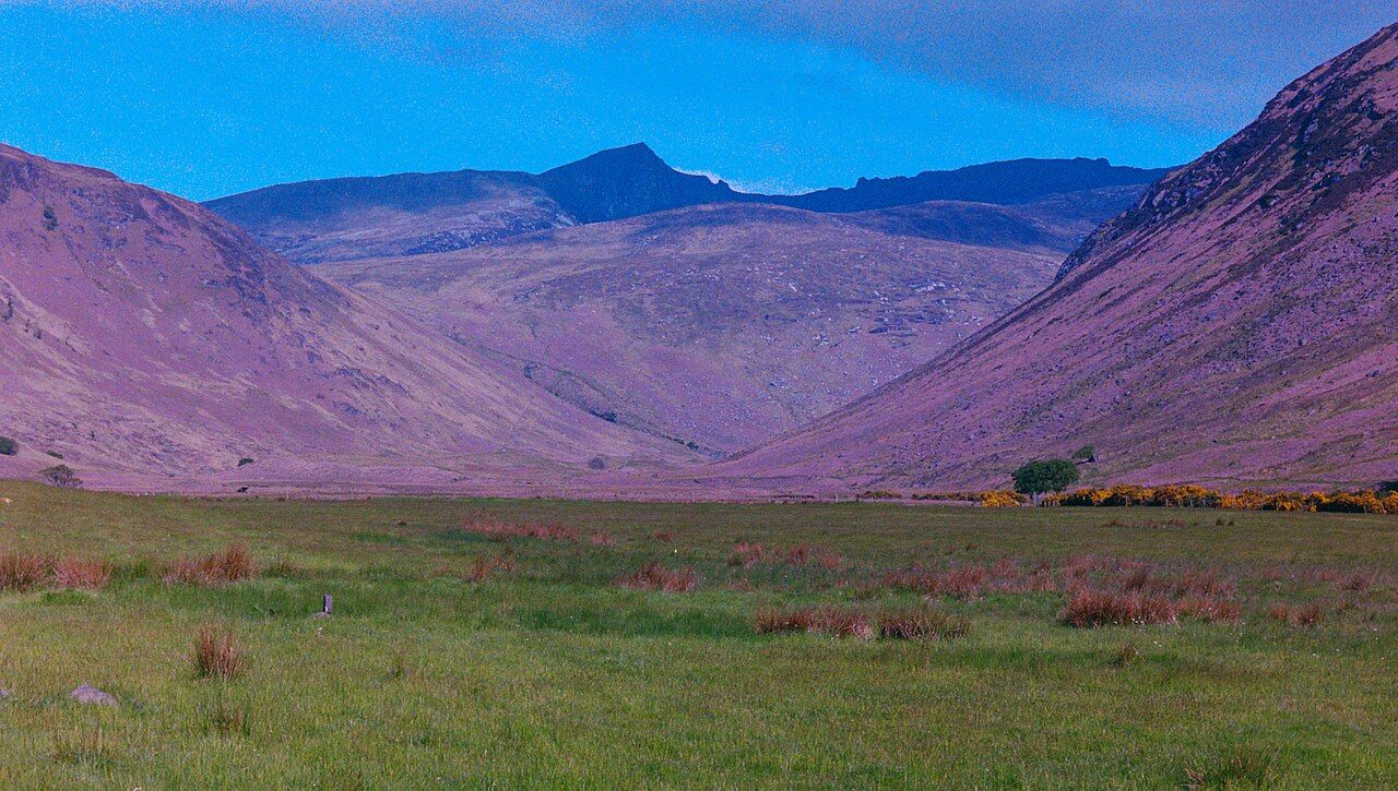
My sister hates hills. That makes her a useful measure of a walk whose interest is not only in reaching higher ground. Glen Rosa offers something to read as it is crossed: a broad valley floor, the water running down it and granite hills at its head. The glen’s shape is the point. The ice did not simply pass through; it deepened the valley.
What makes Glen Rosa different?
Glen Rosa runs north-west from near Brodick into the heart of the northern granite hills. Its broad floor was deepened by glaciers. That is a concise description, but it also gives the walk a subject. The floor is not just the space between the hills. Its breadth is the evidence.
The glen is at its most readable when its broad floor is treated as evidence, not scenery.
There is a useful distinction here between a valley as a route and a valley as a form. Glen Rosa is both. It leads towards the granite hills, but its width and shape ask for attention in their own right. A narrow gap might draw the eye towards the route ahead; here, the breadth is part of what deserves looking at.
The glen is at its most readable when its broad floor is treated as evidence, not scenery.
What does the broad floor tell us?
The glen’s broad floor records the effect of glaciers. That is the central fact, and it is enough to make the walk more interesting than a simple approach to a peak. The shape gives the valley a clear character: a wide floor set within a landscape of granite hills, rather than a mere line leading upwards.
It is tempting to make the ice the whole story. That would be too neat. The value of the glen is that its glacial form remains visible alongside the water and the hills, not that every part of the landscape can be reduced to a single explanation. The shape is the starting point for looking, not a reason to stop.

What changes along the walk?
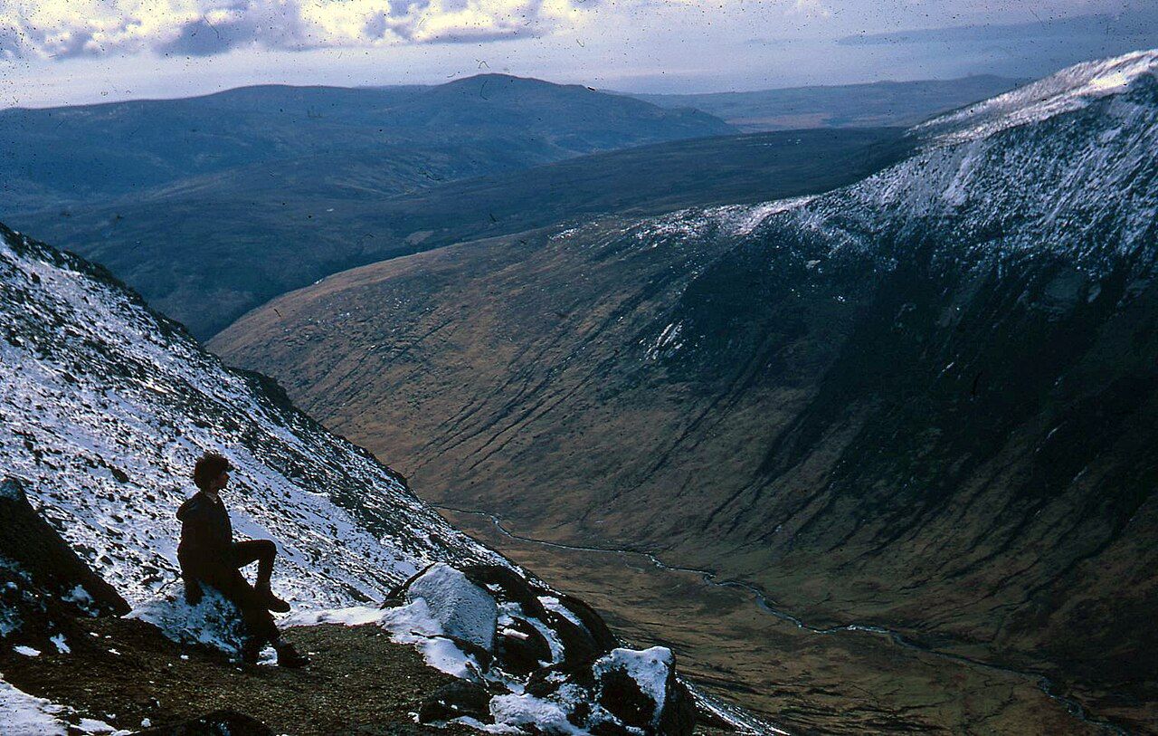
A track leads up the lower part of Glen Rosa before becoming a rougher path. That change matters to the feel of the walk: the glen is not one uniform passage from Brodick to the hills. Its lower section has a track; farther up, the way is rougher. The change is plain enough to describe without dressing it up as an adventure.
The Glenrosa Water flows down the glen and enters the sea at Brodick. That gives the valley a line running through it, from the hills towards the shore. The water is not a decorative extra to the glacial shape. It is part of the sense of the glen as a route through the landscape, with its own direction.
What does the Garbh Allt add?
The Garbh Allt is a burn with deep pools, joining the Glenrosa Water from the west. It offers a detail at a smaller scale than the valley’s wide floor. That contrast is useful. The glen can be read in broad terms, through its shape and its direction, but the joining of the two waters gives it a more particular point of attention.
There is no need to claim that every feature competes for notice. The valley’s form remains the main event. The Garbh Allt is a detail that rewards a closer look without changing the basic judgement: Glen Rosa is strongest when the walk is understood as a passage through a shaped landscape, not simply a line towards a summit.
Why does the view draw north?
Cir Mhor stands at the head of Glen Rosa and dominates the view up the glen. It gives the valley a focus. The broad floor leads the eye in that direction, and the peak makes the far end feel like an answer to the glen’s long approach. the peak at the head of the glen is not a separate attraction bolted onto the walk; it belongs to the view that gives the glen its shape.
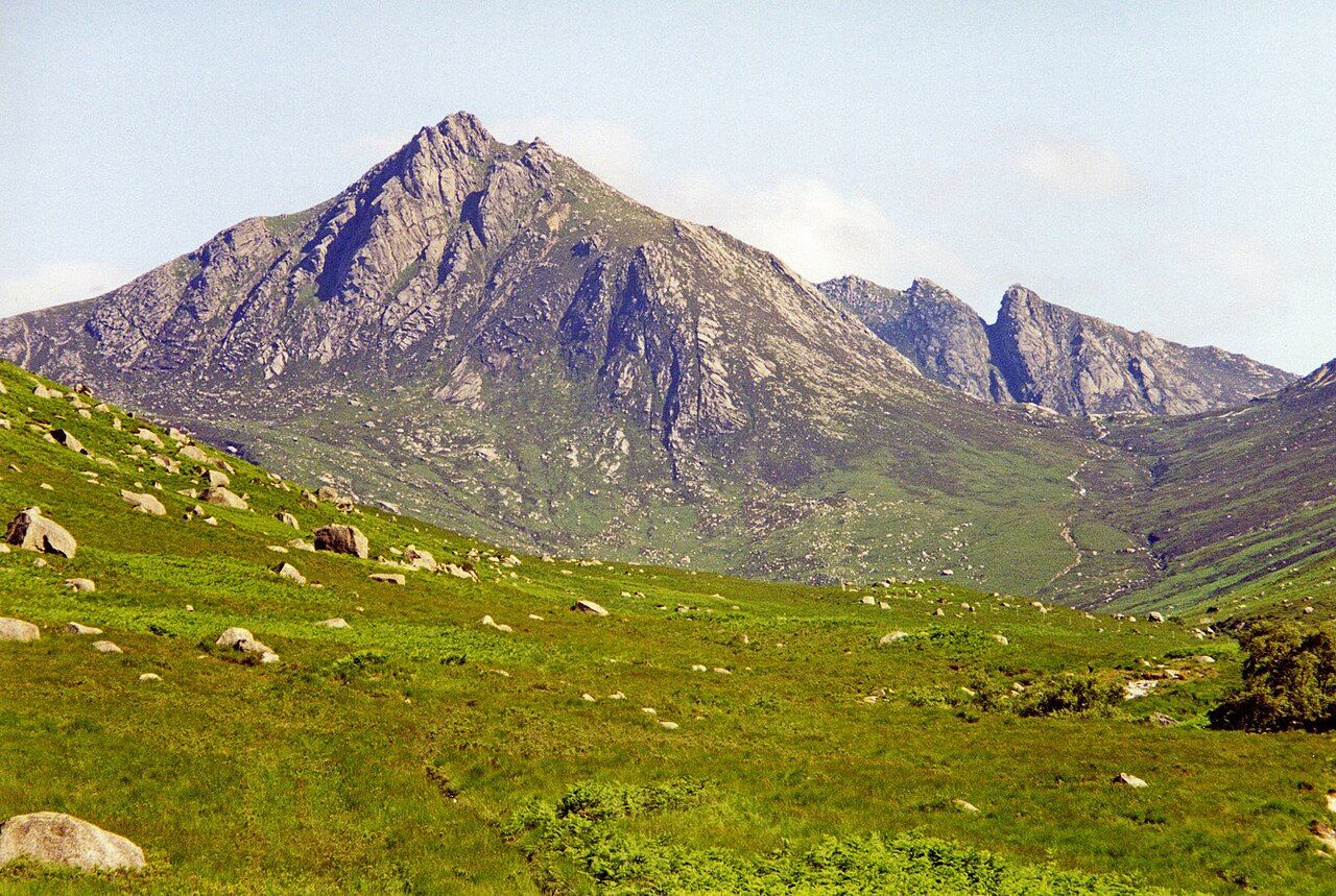

The A' Chir ridge forms the western wall of upper Glen Rosa. That wall gives the upper glen a stronger sense of enclosure than the broad floor alone might suggest. the ridge on the glen's west side is part of the structure of the view, not just another name in a list of hills. Glen Rosa works because the parts relate: floor, water, ridge and peak.
Where does the path lead?
The path up Glen Rosa ends at the Saddle, a granite pass between Cir Mhor and North Goatfell. The name marks a change in the walk’s direction as much as a destination: from the Saddle, a path drops steeply on the far side into Glen Sannox. the glen over the Saddle belongs to the same mountain passage, but the steep drop makes clear that the far side is not simply a continuation of the broad floor.
The Saddle is a fitting end to a walk read through its landforms. The path reaches a pass between two named peaks; the glen has led to a narrower point between the hills. That is a satisfying shape for the route. It also helps explain why the lower valley and its broad floor matter: they are not merely the approach to the pass, but the part that makes the journey coherent.
Is the glen worth the attention?
Yes, particularly for anyone who likes a walk to offer more than a destination. Glen Rosa’s appeal is not a claim that it outdoes every neighbouring glen. It is that its main feature is legible: a broad floor, deepened by glaciers, with the Glenrosa Water running through it and granite hills closing the view at its head.
The walk has a clear centre of interest and a clear end at the Saddle. But it is the valley itself that earns the time. The peaks make a strong finish; the glen gives the walk its argument.